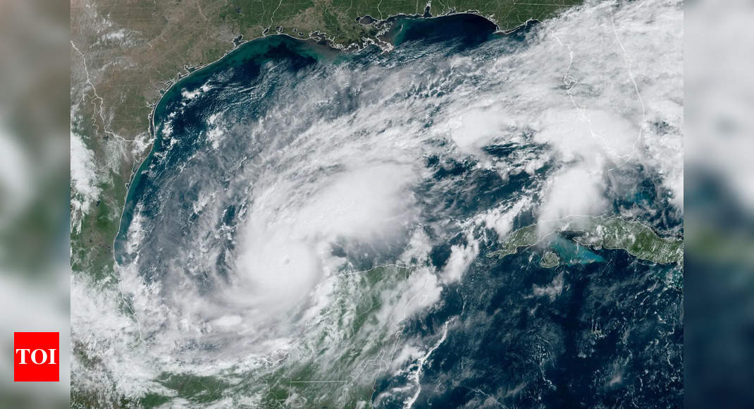
Ocean heat acted as a catalyst for Hurricane Milton, which rapidly intensified from a Category 1 to a Category 5 storm in just a few hours on Monday, surprising even seasoned meteorologists.
Milton’s winds reached an astounding 180 mph, marking it as the fifth most intense Atlantic hurricane on record. Although it has weakened slightly, experts remain concerned about the possibility of it regaining strength.
Storms like Milton, which undergo rapid intensification, have become increasingly common in recent years due to the accumulation of greenhouse gases that trap heat in the atmosphere.This has led to record-breaking temperatures both on land and in oceans, which, in turn, fuel storms. The deeper and warmer waters of the Bay of Campeche and the Gulf of Mexico played a key role in Milton’s rapid growth, according to AccuWeather’s lead hurricane expert, Alex DaSilva. He explained that these waters, reaching depths of hundreds of feet, provided the energy necessary for Milton’s explosive intensification.
DaSilva also noted that the ocean heat content in the Gulf is at its highest level ever recorded for this time of year, even after the recent passage of Hurricane Helene.
Since the 1970s, researchers have observed a worrying trend in the North Atlantic, with the number of storms intensifying into powerful Category 4 or 5 hurricanes roughly doubling, highlighting the link between rising global temperatures and the increasing strength of these storms.
Mass evacuations are currently underway along Florida’s Gulf Coast as Hurricane Milton approaches.
Here’s the latest:
• Forecast update: Hurricane Milton has temporarily weakened to a Category 4 storm overnight but is expected to regain Category 5 strength later today. Though forecasted to weaken slightly before landfall, the storm is likely to grow in size, increasing its destructive potential across a wider area.
• Landfall location: Milton is predicted to strike Florida’s Gulf Coast on Wednesday as a Category 3 hurricane. The dangerous eye and eyewall could make landfall anywhere from Cedar Key in the north to Naples in the south, with Tampa and Fort Myers among the potential areas affected.
• Previous storm impact: Less than two weeks ago, Hurricane Helene hit Florida’s Big Bend as a Category 4 storm, resulting in at least 20 fatalities. Now, officials warn that Hurricane Milton could cause even more severe and widespread destruction, prompting mass evacuations and intense preparations along Florida’s Gulf Coast.
Hurricanes are categorised using the Saffir-Simpson scale, which measures their intensity based on wind speeds. Here are the five categories:
Category 1: Wind speeds of 74-95 mph; minimal damage but can cause power outages and some flooding.
Category 2: Wind speeds of 96-110 mph; moderate damage to buildings, especially roofs, with significant power outages.
Category 3: Wind speeds of 111-129 mph; extensive damage, with a high risk of life-threatening flooding and infrastructure damage.
Category 4: Wind speeds of 130-156 mph; severe damage to structures, uprooting trees and causing widespread power loss.
Category 5: Wind speeds of 157+ mph; catastrophic damage, with homes destroyed, severe flooding, and long-term infrastructure loss.


