The last day of the 2024 Atlantic Hurricane Season is Nov. 30, but as we near that finishing line, the Caribbean has other thoughts in mind, with a potential tropical system brewing.
The National Hurricane Center said Wednesday afternoon that Potential Tropical Cyclone 19 has formed in the western Caribbean. If it reaches tropical storm strength, it will be named Sara. Hurricane and tropical storm watches have been issued for parts of Honduras and Nicaragua.
The storm was forecast to strengthen into a tropical storm on Thursday, the hurricane center said. It’s expected to approach the north coast of Honduras late Friday and potentially stall there into the weekend, bringing the possibility of life-threatening flash flooding to the Central American nation.
CBS News
Hurricane hunters are scheduled for a flight to the area Thursday to investigate the strength and structure of the developing weather system.
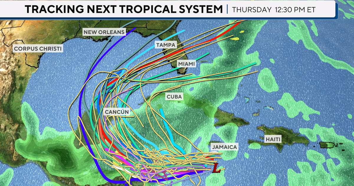
With the low pressure system in place in the western Caribbean, conditions were favorable for the formation of a tropical system. Forecast models take in the current environmental factors along with historical data to compute “spaghetti plots” of where systems may track. Each model uses different computations, which explains how the forecast track is an output of the consensus from those models.
CBS News
This system’s strength is determined based on how much fuel it has — factors such as being in a favorable environment over warm waters, low wind shear, no intercepting fronts — and how long it remains in those favorable conditions. No matter its strength, the forecast models have it lingering in the western Caribbean through the weekend before turning to the north and into the Gulf of Mexico early next week.
CBS News
After entering the Gulf, the consensus of the forecast models has it making a right-hand turn and heading toward Florida by late next week.
A lot can happen between now and next week and conditions can quickly change, but areas like Jamaica and the Cayman Islands need to brace for heavy rains in the next few days. Florida residents should continue to monitor the forecast as updates come in.


