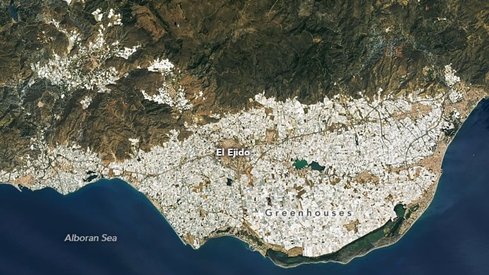
NASA just confirmed that largest structure visible from space isn’t actually the Great Wall of China
Forget what you've heard about the Great Wall of China being the…

NASA Satellite Detects Tree Leaf Changes as Early Volcano Eruption Warning Signal
NASA scientists might soon be able to forecast volcanic eruptions by monitoring how…

U.S. Deploys Bombers Near Iran As Trump Warns Of Strike If Nuclear Talks Collapse | Watch
The U.S. has positioned ten strategic bombers, including B-2s and B-52s, at…

Greenland’s Melting Glaciers Expose 1,620 km of New Coastline Since 2000
Greenland's melting glaciers have exposed 1,620 kilometers of previously ice-covered coastline in…

Satellite Images Reveal the Widespread Destruction of Los Angeles Fires from Space
The ongoing wildfires in Southern California have caused extensive destruction, with over…

Google Maps to now clearly mention flyovers, show road width in India: Take a look at other new features
Google Maps is rolling out several new features in India, aiming to…